
Билэ:Gulf Stream water temperature.jpg
Бу ойуу маннааҕар улахан торума суох.
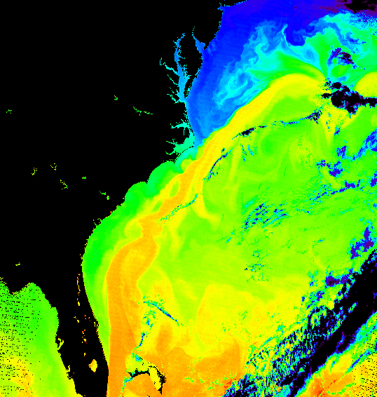
Gulf_Stream_water_temperature.jpg (538 × 566 пииксэл, билэ кээмэйэ: 438 Кб, MIME тиибэ: image/jpeg)
Быһаарыы
| Быһаарыыта |
Español: Temperatura del agua en la Corriente del Golfo.
English: False-color image of the temperature of the Gulf Stream
|
| Күнэ-дьыла | |
| Хантан ылыллыбыта | |
| Ааптар | Donna Thomas/MODIS Ocean Group NASA/GSFC SST product by R. Evans et al., U. Miami |
Лицензиялааһын
| Этот файл находится в общественном достоянии (англ. public domain), так как он был создан NASA (Национальным управлением по аэронавтике и исследованию космического пространства). Политика авторского права NASA гласит, что «Материал NASA не защищается авторским правом, если не указано иное». (См. Template:PD-USGov, страницу политики авторского права NASA или политику использования изображений JPL.) | ||
 |
Предупреждения:
|
Билэ устуоруйата
Ыйын-күнүн/кэмин баттаа, оччотооҕуга баар буолбут.
| Күнэ-ыйа/Кэмэ | Ойуучаан | Кээмэйдэрэ | Кыттааччы | Хос быһаарыы | |
|---|---|---|---|---|---|
| билиҥҥи | 16:53, 17 Муус устар 2005 | | 538 × 566 (438 Кб) | Mschlindwein | False-color image of the temperature of the Gulf Stream |
Билэни туттуу
Бу билэни бу сирэй туһанар:
Билэни киэҥник туттуу
Бу билэ маннык биикилэргэ туттуллар:
- Манна ast.wikipedia.org туттуу
- Манна az.wikipedia.org туттуу
- Манна ba.wikipedia.org туттуу
- Манна be.wikipedia.org туттуу
- Манна bg.wikipedia.org туттуу
- Манна cs.wikipedia.org туттуу
- Манна cv.wikipedia.org туттуу
- Манна da.wikipedia.org туттуу
- Манна el.wikipedia.org туттуу
- Манна en.wikipedia.org туттуу
- Манна en.wikibooks.org туттуу
- Манна es.wikipedia.org туттуу
- Манна fa.wikipedia.org туттуу
- Манна fi.wikipedia.org туттуу
- Манна fi.wikibooks.org туттуу
- Манна fr.wikipedia.org туттуу
- Манна gl.wikipedia.org туттуу
- Манна he.wikipedia.org туттуу
- Манна hu.wikipedia.org туттуу
- Манна is.wikipedia.org туттуу
- Манна it.wikipedia.org туттуу
- Манна ko.wikipedia.org туттуу
- Манна nl.wikipedia.org туттуу
- Манна nn.wikipedia.org туттуу
- Манна no.wikipedia.org туттуу
- Манна oc.wikipedia.org туттуу
- Манна pt.wikipedia.org туттуу
- Манна ru.wikipedia.org туттуу
- Манна sh.wikipedia.org туттуу
- Манна sk.wikipedia.org туттуу
- Манна sq.wikipedia.org туттуу
- Манна sr.wikipedia.org туттуу
- Манна tr.wikipedia.org туттуу
- Манна uk.wikipedia.org туттуу
- Манна vls.wikipedia.org туттуу
Билэ киэҥник туттуллуутун көрүү.